
Come camp on the Ranch - quiet, private & off the highway.

Hat Creek Hereford Ranch Rv Park &
Campground
A Little Piece of Heaven
To view site details & availability please
click the reservation link below.
(plus taxes and fees)
Site Rates
Treed Tent Site: $48 - $52 /night
Grass Tent Site: $52 - $59 /night
Full Hookup RV Site: $65.- $69/ night
Water & Electric Only & Grass RV Sites:
$65 - $69/ night
Cabins are available for $85. Lassen cabin - $94/night Hat Creek cabin
** Rates are subject to increase on Fri/Sat and holiday weekends


Welcome to the Hat Creek Hereford Ranch RV and Campground.
We are so happy you found us! Whether you are new to the area or have been making memories for generations, we are excited be your home base for all your far norcal adventures!
Be sure and check out all the amazing things to see and do in our beautiful area, a few of which are highlighted below. Get those camp supplies packed start planning the ultimate Far NorCal Adventure today!

Camping season is upon us! Grab your gear and head on up!
Cant wait to see you round the creek.
Open Mid April - Mid October for all your adventuring and relaxation needs.
In Season Store Hours:
(May - September)
Mon - Thurs: 9 am - 5 pm
Fri & Saturday 9 am - 6pm
Sun: 9 am - 5 pm
Directions to the park: **Do not follow Google Maps or GPS, you will end up in a private driveway. Stay on Hwy 89 until you see Doty Loop and the sign for Hat Creek Hereford Ranch RV Park & Campground.
-
From Susanville or Hwy 44: Doty Road is approx. 11.5 miles northwest of Old Station.
-
From Burney or Hwy 299: Doty Road is approx. 10.5 miles southeast of Hwy 299 and Hwy 89 intersection (also known as four corners).
Physical Address: 17855 Doty Rd.
Hat Creek, CA 96040
Mailing Address: 41397 Opdyke Ln.
Hat Creek, CA 96040
About


The Area
Where are we Located
Hat Creek is located 26 miles (42 km) north of Lassen Park, 13 miles (21 km) southeast of Burney (9 miles (14 km) south of the junction of Hwy 89 and 299), and 15 miles (24 km) south of Burney Falls.


Fishing
What Sets Us Apart
We have a well stocked trout fishing pond on the grounds that is reserved only for our guests. Hat Creek Hereford RV Park is now paying nearly $6 per fish to a private trout farm to stock our pond for your enjoyment. If we are to continue stocking the pond, please comply with the rules below. We are transparent about what we pay for these fish and the delivery receipt is posted in our office.
The 2026 fishing pass prices are $18 per day (11 yrs and older) with a 3 fish limit and $12 per day for children
(ages 6 - 11) with a 2 fish limit. Children under 6 are free as long as they are fishing with an adult who has a permit. Please purchase a fishing permit/band at the Camp office. You must wear your bands while fishing.
People always want to know how close the creek is. The creek is on the property & directly behind the fishing/swimming pond. Hat Creek is approximately 100 yards from the main office. We have access to the creek for an approximate 3/4 miles with a fence line that crosses the creek in a few places and can NOT be crossed.

Courtesy of California State Parks, 2025
Burney Falls
State Park
McArthur ~ Burney Falls Park is located in the foothills of the Cascades and Modoc Plateau between statuesque Mt. Shasta and Mt. Lassen. The 129-foot scenic falls is ranked among the best in California and the park is situated within easy driving distance of some of the most spectacular natural settings to be found anywhere in the United States. The nearby availability of a wide-variety of activities--- golf, hunting, shooting, fishing, boating, birding, hiking, horseback riding, photography, history and more... make the park the perfect place to spend not only a brief visit, but also an extended vacation


Mt. Lassen
National Park
Lassen Peak, also called Mount Lassen, volcanic peak in northern California, U.S., the principal attraction of Lassen Volcanic National Park. The peak stands at the southern end of the Cascade Range, some 50 miles (80 km) east of Redding, and rises above the surrounding area to an elevation of 10,457 feet (3,187 meters). It is classified as a volcanic dome, formed when lava is too viscous to flow away and accumulates around its vent.


Subway Caves
Forest Service
Subway Cave is a lava tube that was formed during volcanic events just twenty thousand years ago, but today it offers an unusual hiking experience in an area of very interesting and recent geologic activity. The trailhead is located less than half a mile from the junction of Highway 89 and Highway 44 in Old Station.


Fall River Valley Golf Course
Beautiful 18 hole golf course just 25 minutes from our Campground
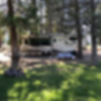
Camp on a private & pristine ranch surrounded by green fields, fish Hat Creek and our stocked lake. We are in Lassen National Forest not far from Burney Falls and Lassen Volcanic National Park, both famous for their beauty. We have RV sites and tent sites with options of grass for each, a Store with some groceries,
Ice, Ice cream, fishing & RV supplies, goodies, fire pits, picnic tables, hot showers, laundry, restrooms, playground, sandy swim beach, horseshoes, fishing, ping pong & Free WIFi!
